kunanyi – Mt Wellington in the snow!

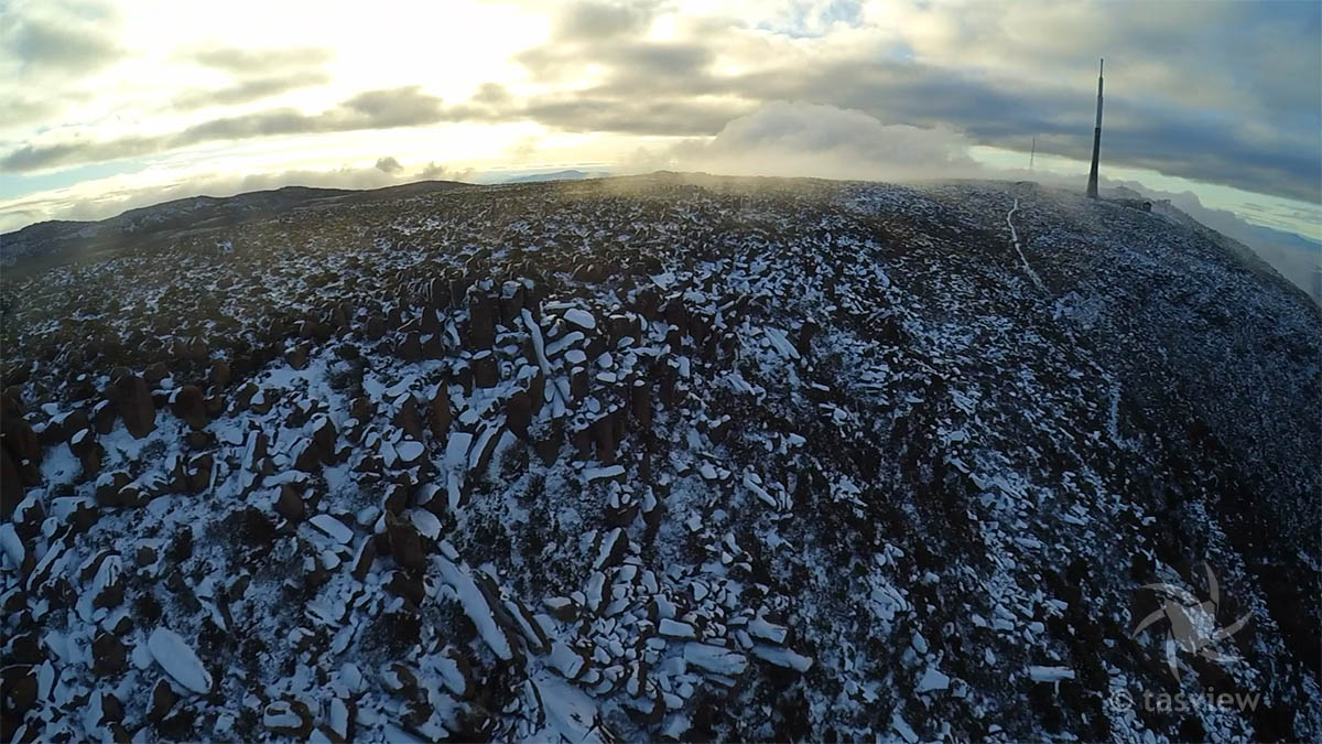
After checking the road to the top was open and great wind conditions, I braved the cold and headed up Hobart’s mountain backdrop to play with my F550 in the snow! I walked about 30 minutes south of the carpark and giant radio/tv tower to the boulder fields. The sky’s were clear on takeoff, but 12 minutes later the cloud came in and I hastily landed to retrace my steps in the mist with reduced visibility on a poorly marked track.
Here are some stills from the flight video using Xiaomi Yi – well worth the effort 🙂

Drone view of the bolderfield south of the summit.
Drone view of the bolderfield south of the summit of Mt Wellington, taken from over the edge!
Panorama of Hobart from kunanyi - 3 photos stiched from video.
Panorama of Hobart from kunanyi – 3 photos stiched from video.
kunanyi - Mt Wellington.The big cloud over the hill was on me in 12 minutes.
kunanyi – Mt Wellington.The big cloud way over the hill was on me in 12 minutes.
Closer shot of the bolder fields on Mt Wellington.
Bolder Fields as the cloud closed in.
Bolder Fields as the cloud closed in. Can you find me in this Pic?

Leave a Reply

Fill in your details below or click an icon to log in:

WordPress.com Logo

You are commenting using your WordPress.com account. Log Out /  Change )

Facebook photo

You are commenting using your Facebook account. Log Out /  Change )

Connecting to %s